
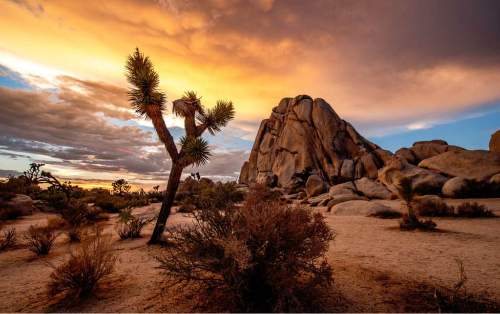
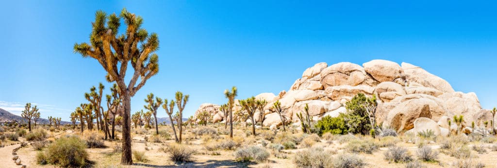
If you’re looking to get outdoors and explore our National Parks, chances are you’re considering a visit out to California. With nine National Parks, California is a destination to travel up and down the coastline of the state and see different topographies along the way. One of the most popular parks to head to is Joshua Tree National Park.
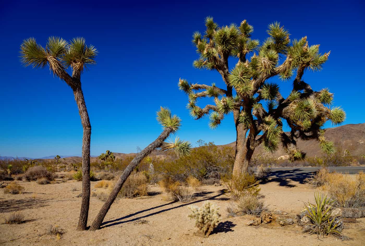
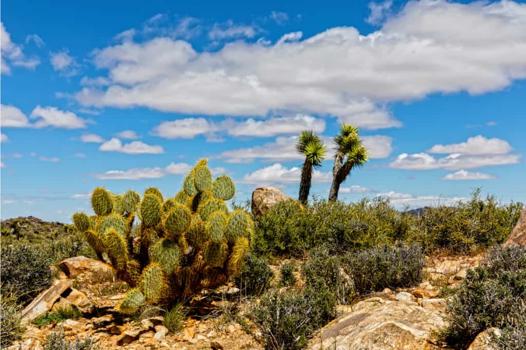
Joshua Tree is the second largest National Park in California behind Death Valley. Visitors can only see about 15% of the park, as the rest is left to the natural wilderness. You can see two separate desert ecosystems in the park: the Colorado Desert and the Mohave Desert. Interestingly enough, the namesake of the park isn’t actually a tree, it’s a yucca plant! Primarily found in the Mojave Desert, Joshua Trees can live up to 150 years and only grow 1-3 inches a year.
2.8 million people will visit the park annually, with peak season being from March to May where temperatures are more moderate, and wildflowers are in their full bloom. Another draw of the park is its mining history, with a number of the popular hikes featuring abandoned mines and mining equipment.
Being that it is a desert, visitation increases in the fall and spring, and lowers in the summer. Joshua Tree is open 24 hours a day, and visitor centers start to open at 7:30 am until 5:00 pm; this includes federal holidays.
If you are planning your visit during the busy fall and spring season, there are some ways to navigate the crowds at Joshua Tree. First, plan on visiting during the week since most of the crowds will appear on weekends or holidays. You can also buy your pass online before heading in, which saves you time at the entrance station. And finally, due to the weather and crowds, it is best to arrive and park your car before 10:00 am. The busiest time to enter the park is between 10:00 am and 2:00 pm.
BEFORE ENTERING THE PARK
With two deserts in the park, Joshua Tree is known for being hot. If you are looking to go in the spring and fall, you will only risk high temperatures of 85 degrees Fahrenheit. During July, the hottest month of the year in Joshua Tree, you can expect average temperatures in the low 100’s Fahrenheit. With minimal tree cover and natural shade, if you are going in the summer, be sure to bring a lot of water and sun protection.
Conversely, the average winter temperature is in the upper 30s. If you do plan to visit Joshua Tree during the colder, less crowded months, bring layers. While some visitors have gotten hypothermia, if you pack your backpack properly and are prepared, Joshua Tree is a year-round destination!
Joshua Tree shut down their Roadrunner Shuttle Service after the 2019 season, so you will need access to a car to get to and around the park. It is recommended you buy a digital pass online instead of at the gate to save on time. If you are staying in the park, you may be under a burn ban to limit unregulated fires.
DAY ONE IN JOSHUA TREE NATIONAL PARK
The most popular entrance to Joshua Tree National Park is on the north side from Highway 62 near the town of Joshua Tree itself. Take Highway 62 east until you see Park Boulevard, which becomes Quail Springs Road as you enter the park through the West Entrance Station. If going during the cooler weather of fall or, especially, spring, you’ll want to arrive early to avoid traffic being backed up at this entrance station.
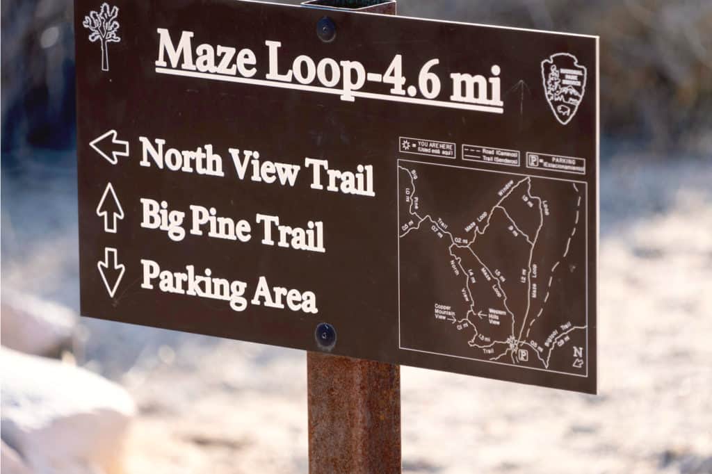
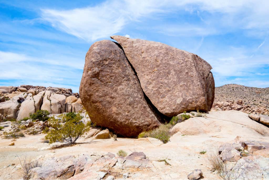
STOP 1: THE MAZE LOOP
Length: 4.7 miles
Elevation Gain: 360 feet
Type: Loop
Difficulty: Moderate
Estimated Time to Complete: 2 hours and 15 minutes
You won’t have to drive far into the park to find your first hike of the trip! Don’t let the name fool you, this trail is a lot of fun and quite easy to follow. If you come during wildflower season, this is a great place to view the bloom! While this trail has a moderate difficulty rating, you won’t need to prepare for a large amount of elevation gain. Almost the entirety of the elevation gained happens in the first 1.3 miles and the rest is either flat or a moderate decline, giving you ample time to rest your legs as you finish the loop. This is a popular trail, so starting your day early will benefit you.
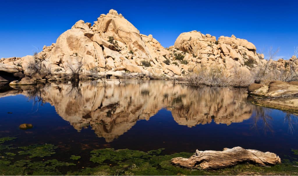
STOP 2: BARKER DAM NATURE TRAIL
Length: 1.3 miles
Elevation Gain: 62 feet
Type: Loop
Difficulty: Easy
Estimated Time to Complete: 40 minutes
Just how much water is in the dam depends on the time of year you go and what kind of rains Joshua Tree has had. While it’s a more fun hike with water around the halfway point, this flat leg-stretching trail is always worth a visit, no matter what time of year! About 0.4 miles into the trail (if you take the loop left) you’ll find petroglyphs to your left. Take lots of pictures, but please refrain from climbing on the site itself so it can continue to be preserved.
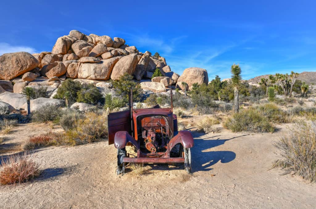
STOP 3: WALL STREET MILL TRAIL
Length: 2.4 miles
Elevation Gain: 88 feet
Type: Out and Back
Difficulty: Easy
Estimated Time to Complete: 1 hour
A prominent part of Joshua Tree’s history is its roots in the Old West and the mining activities that went on here before the park was established. History enthusiasts will especially enjoy this trail as the turnaround point is an abandoned mine. You’ll also find the trail’s namesake, the Wall Street Mill here. Throughout the trail are remnants of the park’s history as well, like the remains of old cars and windmills along the trail. You may want to download a trail map ahead of time as it isn’t usually on the maps at the visitors’ center, although the trail does have signs and markers.
If you’re looking for a place to stay, the Sheep Pass Campground is just up Park Boulevard on the pull-off for Sheep Pass Campground Road. If you want to backtrack towards the Wall Street Mill area, you’ll find Hidden Valley Campground if you take the Park Boulevard back the way you came and turn right before Intersection Rock and take a quick left onto Hidden Valley Campground Road.
DAY TWO IN JOSHUA TREE NATIONAL PARK
If you opted to camp in the park, you’ll be able to roll out of bed and head straight to the trailhead. This is especially true if you chose to camp at the Ryan Mountain Campground. If you chose to stay in town, you can see the Fry Boulders on your left as you pass Cap Rock going towards Ryan Mountain. If you stayed at Ryan Mountain, the Fry Boulders are immediately on your left as you go left onto Park Boulevard. If you camped at Sheep Pass Campground, you’ll have to backtrack just a bit to start at Ryan Mountain.
STOP 1: RYAN MOUNTAIN
Length: 3 miles
Elevation Gain: 1,069 feet
Type: Out and Back
Difficulty: Moderate
Estimated Time to Complete: 2 hours
Ryan Mountain is a challenge best tackled first thing in the morning. While only three miles long, the elevation gained is what makes the trail take about 2 hours to complete. If you want to have a shorter second day, you could consider doing this as a sunset hike to end your first day, depending on how up to the task you feel. Sunrise could also be an enjoyable way to take on this hike should you decide to stick with the itinerary as it stands.
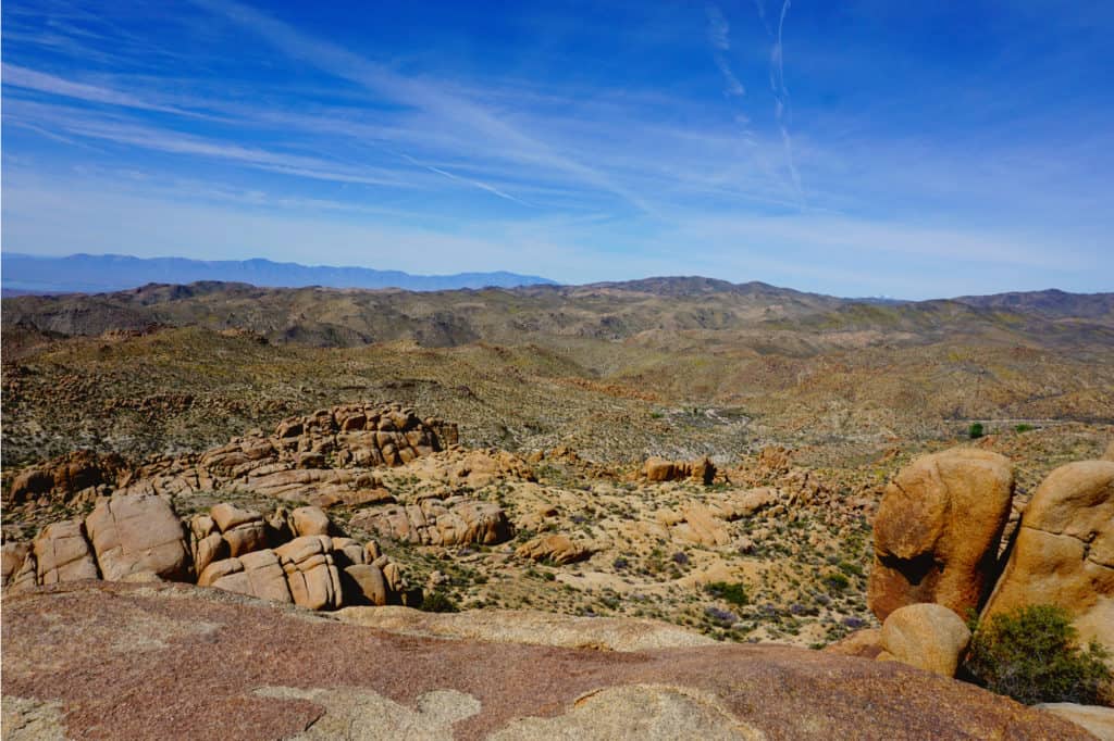
While there is plenty of elevation to be gained, it is a gradual uphill for about a mile and a half. While not easy, it’s a challenge most hikers should be up for (assuming you take your time). The mile and a half return is a rewarding, gradual downward slope. At 5,456 feet at the peak, Ryan Mountain gives you a great view of the surrounding land when you make it to the top!

STOP 2: SKULL ROCK NATURE TRAIL
Length: 1.7 miles
Elevation Gain: 160 feet
Type: Loop
Difficulty: Easy
Estimated Time to Complete: 50 minutes
Passing the popular Jumbo Rocks Campground (if you’re looking for a place to spend the night) will get you to the Skull Rock Nature Trail. Skull Rock itself is actually at the beginning of the trail just off to the left. This loop trail is short, flat, and easy for all hikers. A welcome change of pace after Ryan Mountain! Jumbo Rocks will be off to your left about 0.3 miles in. Take your time on this trail is does tend to be one of the more congested hikes in Joshua Tree, especially during peak season. The trail’s popularity is due in large part to the fact that there are so many good places for photos!
STOP 3: SPLIT ROCK LOOP TRAIL
Length: 1.9 miles
Elevation Gain: 252 feet
Type: Loop
Difficulty: Easy
Estimated Time to Complete: 1 hour
Continue up Park Boulevard until you see the first left turnoff which takes you to the Split Rock Trailhead. Similar to the Skull Rock Nature Trail, Split Rock is at the very beginning of the trailhead, so expect congestion from tourists taking pictures. At just under 2 miles, this is a family friendly trail where you can take your time and enjoy the desert! If you’re short on time today, you can skip this stop and head to the fourth stop of the day.
STOP 4: EAGLE CLIFF MINE
Length: 2.3 miles
Elevation Gain: 580 feet
Type: Out and Back
Difficulty: Moderate
Estimated Time to Complete: 1 hour and 30 minutes
The last stop of the day is another one of Joshua Tree’s famous abandoned mines! The first 0.3 miles of this trail are shared with the Split Rock Trail, so you can combine the two trails into one longer one if you don’t want to hike this section twice. There is not a lot of shade on this trail, so definitely bring water. You may want to have a map of this trail too as it isn’t always marked optimally.
The mine and Eagle Cliff Boulder House are just over a mile in and are worth the taking some time to explore before you head back. It’s a bit of a trek from miles 0.5 to 1 to get to the mine, but the remainder of the trail is flat or downhill.
If a site at Jumbo Rocks isn’t available, continue on Park Boulevard until you can turn right onto Pinto Basin Road. Following Pinto Basin Road will lead you to the Belle Campground Road on the left. If you continue further down the road, the White Tank Campground will also be on the left. Both will put you right next to the first stop on tomorrow’s itinerary.

DAY THREE IN JOSHUA TREE NATIONAL PARK
If you camped at any of the recommendations from the end of Day 2, you’ll be only a few minutes from your first hike of the day! If you camped at White Tank, backtrack up Pinto Basin Road just for a minute until you see the Twin Tanks area on your left.
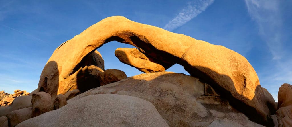
STOP 1: ARCH ROCK NATURE TRAIL
Length: 1.2 miles
Elevation Gain: 88 feet
Type: Out and Back
Difficulty: Easy
Estimated Time to Complete: 30 minutes
Arch Rock is actually on the back side of the White Tank Campground, so you may have caught glimpses of it if you spent the night there! This is a popular trail, especially when wildflowers are in bloom, so start your day early if you can.
The trail that leads to the loop at Arch Rock is a steady downhill on the way out, so you’ll be hiking upwards on the way back. However, the incline is steady and you’ll gain less than 100 total feet of elevation.
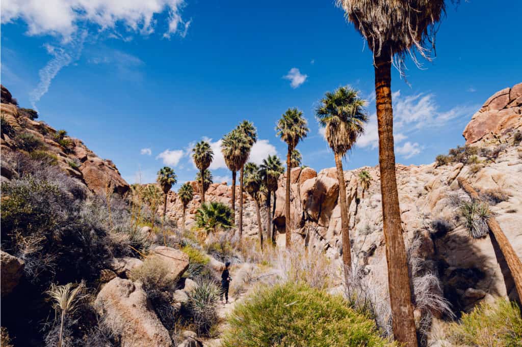
STOP 2: LOST PALM OASIS TRAIL
Length: 7.2 miles
Elevation Gain: 1,026 feet
Type: Out and Back
Difficulty: Moderate
Estimated Time to Complete: 3 hours and 30 minutes
Take Pinto Basin Road almost to the end of the park’s boundary. Look for a left turn just past the Cottonwood Visitor Center and you’ll take that to the road’s end to find the trailhead. This is one of the more popular trails in Joshua Tree National Park. If you’re limited on time, you can skip this trail and just go to the final stop of the itinerary.
This trail is the longest one that you’ll hike in the park, so you can skip the final stop on the itinerary if you don’t feel like one more trek after this one. The incline of this trail is almost an M shape. The first 3 miles or so are a steady incline with miles 3 to 4 being a valley and the remainder of the trail being a downhill. This is definitely a trail you’ll want extra water on, so you may want to skip the final stop if you’re visiting Joshua Tree during the summer.
STOP 3: MASTODON PEAK LOOP TRAIL
Length: 2.6 miles
Elevation Gain: 406 feet
Type: Loop
Difficulty: Easy
Estimated Time to Complete: 1 hour and 30 minutes
If you feel up to one final hike after Lost Palm Oasis Trail, this is an easy loop trail to cap off your time in Joshua Tree. The first 0.7 miles are shared with the Lost Palm Oasis Trail before you take a left for the loop, so you can opt to combine them or re-hike the initial 0.7 miles.
You’ll be missing out on a really fun hike to Mastodon Peak itself as well as the remnants of the Mastodon Mine and Palm Tree Oasis, and that’s just the first mile or so!
All you have to do from here is head back towards Pinto Basin Road and take a left. The road will become Cottonwood Springs Road and take you to the exit that puts you right near the 10 Freeway. If you have extra time, the town of Joshua Tree itself is a unique experience! There are plenty of shops, museums, art galleries, and oddities to enjoy before you continue on your way.
Hopefully this itinerary has helped inspire your next Joshua Tree National Park adventure and we can’t wait to hear all about it!


No Comment